About Me
I am an assistant professor in the Department of Geography and Sustainability at Salem State University in Massachusetts. My research examines how remote sensing and geographic information science can inform urban climate resilience in the northeast USA with a specific focus on urban forestry and environmental justice. My time studying urban forests led to a particular focus on tree planting initiatives in environmental justice communities and arboretums where I specialize in examining how these trees change over time.
I teach classes in Remote Sensing, Geographic Information Science, Global Climate Change, Drone Applications, Global Environmental Sustainability, Advanced Geographic Quantitative Methods, Environmental Science, and Urban Forest Ecology. I am invested in how education can help mitigate the effects of climate change and address long standing social justice issues.
My passion for teaching and research began during my five years teaching Earth Science in the South Bronx where I learned both about the vulnerability of urban areas to climate change and the systemic racism embedded in all aspects of American society but particularly related to the environment and education.
Current Research Interests

Advance understanding of the effects of spatial distribution and composition of urban forestry and ecology
My doctoral work centered around the spatial distribution of tree planting in mid-sized cities like Worcester, MA. I am interested in the spatial distribution of tree species as well as the human interactions and governance that determines urban forest composition. As the impacts of climate change increase – heat waves, floods, extreme weather, pollution – urban trees will play an important role in making our cities more resilient. Mid-sized cities expect to see some of the largest population growth in the next 20 years and these cities also offer a wide variety of landscapes from dense urban centers like Green Island to more suburban neighborhoods like Columbus Park.
Use of UAVs for evaluation of impacts of climate change in urban areas
UAVs (Unmanned aerial vehicles ie. drones) have revolutionized the field of remote sensing and scientists ability to apply remote sensing at small spatial scales. Small patches of vegetation ranging from a living shoreline to a Miyawaki Forest are critical for cities to adapt to climate change impacts. This research aims to support communities in cities making large investments in climate resiliency projects around sea level rise, urban heat island effects, and biodiversity. UAVs are an important tool for communities to get targeted and fast information about their local climate – this research aims to use the drone fleet at Salem State University to both educate about safe and responsible UAV use and demonstrate how UAVs can be used to evaluate climate resiliency projects.
UAVs: Remote Sensing teaching, research, and partnership
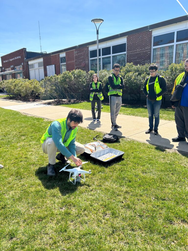
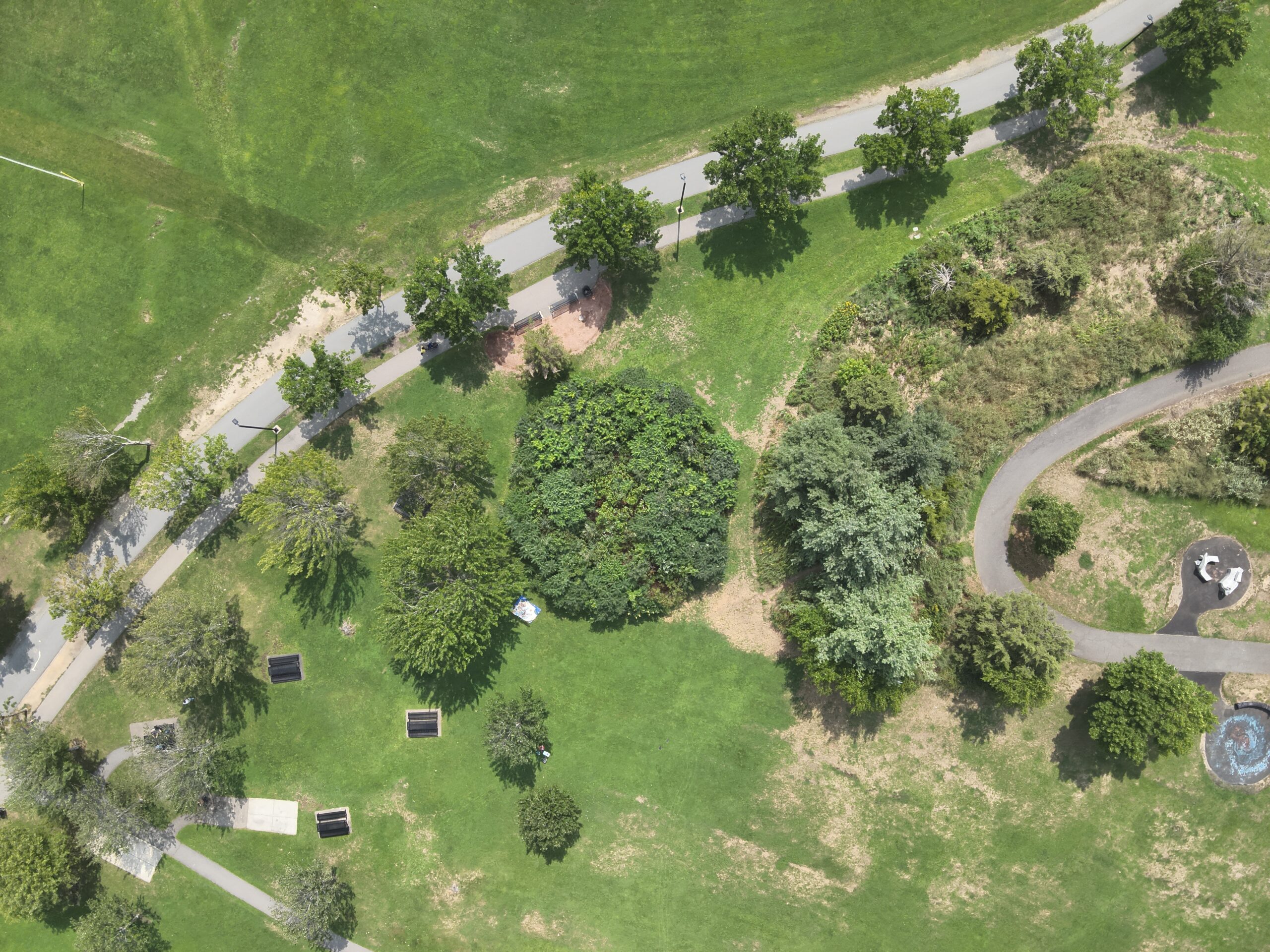
The UAV (drone) program at Salem State University is a massive part of the teaching and research I conduct. I bring drones like the DJI Phantom 4 Pro into a range of classes from my GPH115: Global Climate Change class to the GPH343: Drone Applications class. Drone imagery is used in GPH340: GIS, GPH344: Remote Sensing, and GPH444: Digital Image Processing.
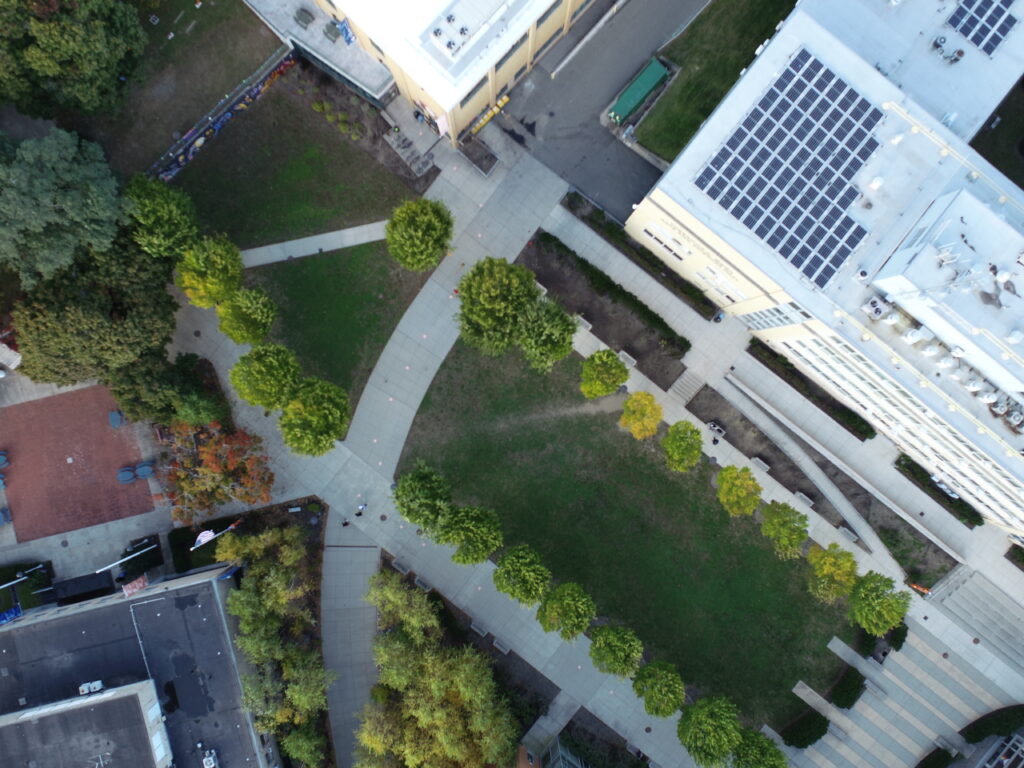
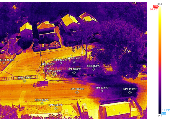
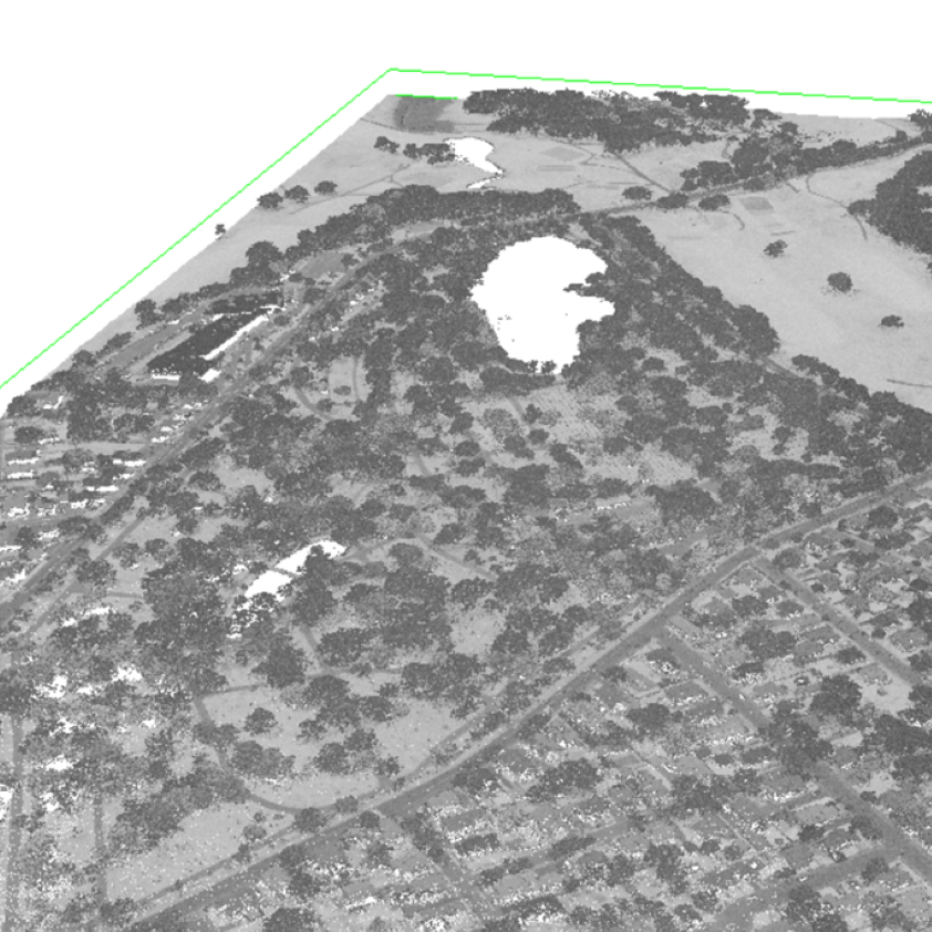
Below are two examples of recent drone work conducted by students in GPH343 analyzing tree health in a cemetery and erosion along a shoreline.
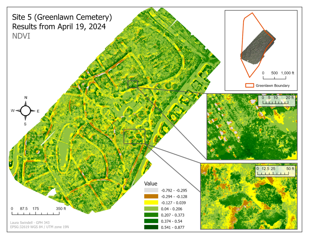
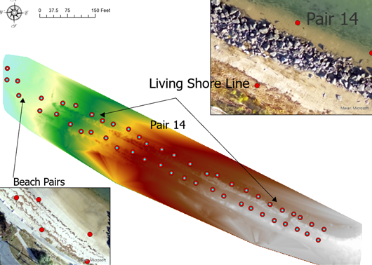
Students in the GPH343: Drone Applications class create reports of their analysis. Below are a range of reports showing how drones can used used for conservation and climate resilience science.
Partnering with Organizations to further Conservation and Impacts of Climate Change
We have flown UAVs with Mass Audubon, Greenbelt Essex County Land Trust, Marblehead Conservancy, Bio4Climate, City of Salem, Michael J Landscaping and many others.
Sometimes these partnerships involve photos and video while other times we apply mapping and analysis.
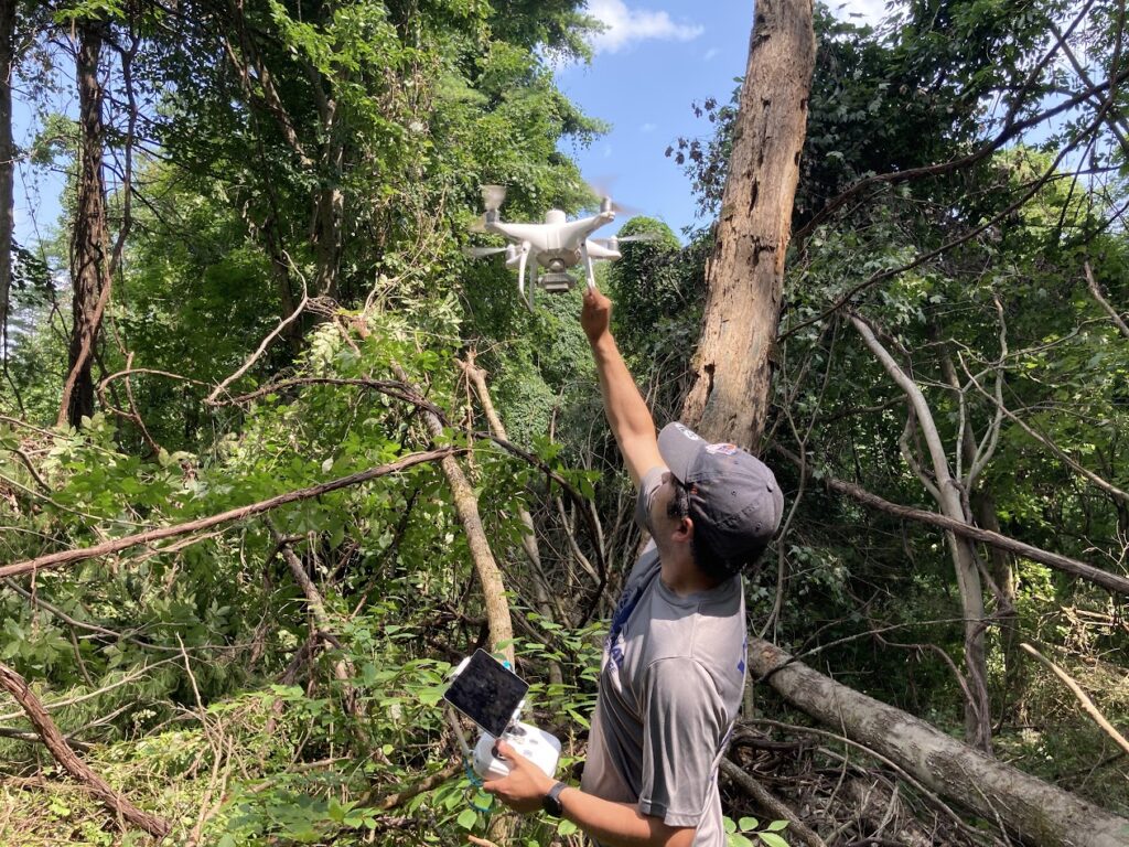
In the photo on the left, I am catching the DJI Multispectral Phantom 4 Pro on a mission to take video and photos to capture the extent of a blowdown in Central Mass.
SURF Lab Projects
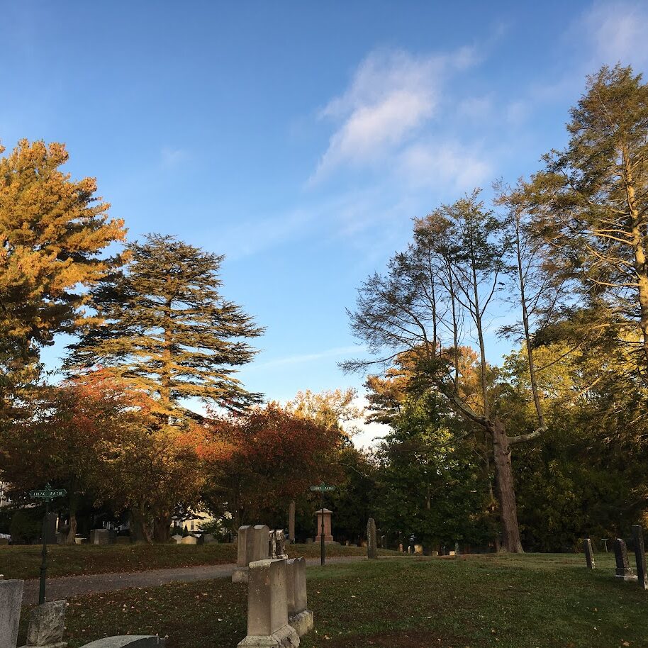
Salem Urban Resilience and Forestry (SURF) lab uses remote sensing and GIS to investigate urban resilience and forestry issues in Salem and beyond. The lab is comprised of student projects in my GPH340, GPH343, and GPH344 classes as well as my personal research. Members of the lab can be undergraduate and graduate students in any of my classes as well as students taking directed study credits. I hope to build partnerships with local organizations like Greenlawn Cemetery and Salem Sound Coast Watch as well as the Greening the Gateway Cities program that is currently planting trees in Salem.


Tree Planting in Salem
Sargent Arboretum
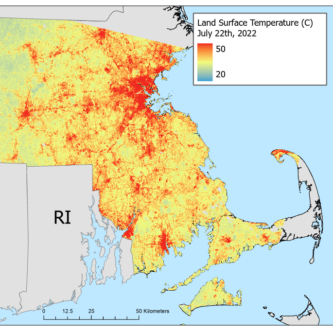

Extreme Heat in Massachusetts

Worcester Street Trees
Teaching

My teaching philosophy is rooted in this concept of lifelong learning which I hope to instill in all my students. For me, teaching is an iterative process requiring methods, materials, strategies, and assignments to be constantly reassessed over the course of a class, semester, year, and career. I encourage students to assert control over their learning experience throughout my courses, starting by providing multiple mediums to access the content: whether through videos, readings, or in-class lectures. Students apply their learning by completing self-directed final projects on topics and data of their choice. Project-based learning is effective at giving students control over their own learning and establishing students’ self-belief that they can achieve the tasks they set out for themselves.
My teaching goals are to connect students with local institutions and organizations such as city planners, local non-profits, land trusts, and members of the private sector to engage critical human-environment challenges. I also aim to involve students with my research goals through SURF lab which will expose my students to academic research.
The classes that I currently teach at Salem State University are:
- GPH115: Global Climate Change
- GPH171: Environmental Sustainability
- GPH340: Geographic Information Science
- GPH343: Drones and Aerial Imagery: Applications and Image Analysis
- GPH344: Remote Sensing
- GPH444: Digital Image Processing and Modeling
- GPH942: Advanced Geographic Quantitative Methods
GPH115: Global Climate Change
In this class, students learn about the causes and impacts of Climate Change as well as potential actions they can take at an individual, organizational, and societal scales to mitigate and/or adapt to the effects. Students examine in depth Salem and Beverly’s Resilient Together Climate Action and Resilience Plan to understand local climate change policies.

GPH340: Geographic Information Science
In this class, students learn about GIS theory, gain experience using ArcGIS Pro and QGIS to display and process spatial data and apply GIS to environmental justice problems. Students design and execute an independent research project. I am always open to collaborating with partner organizations for these projects. Below are some examples of student work from previous semesters.
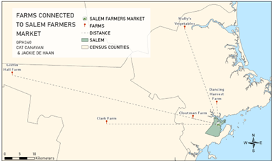
This map shows the location and distance of farms that sell at the Salem Farmers Market.
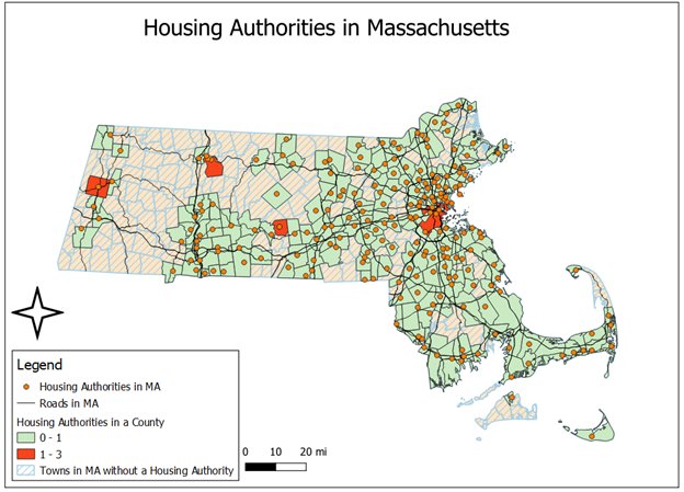
This map shows the location of Public Housing Authorities in Massachusetts. These points were geocoded and then mapped to find where there was a lack of access to housing authorities.
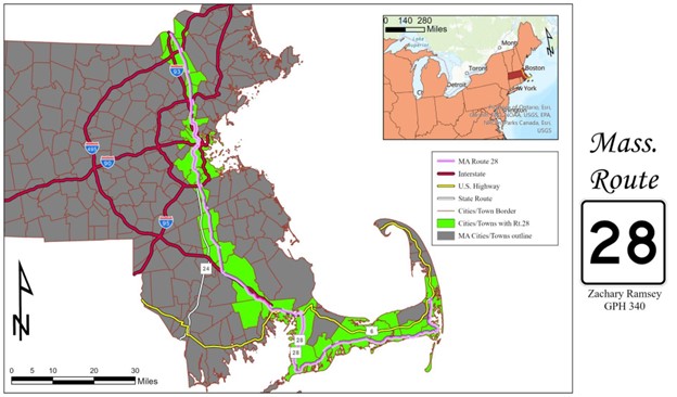
This map shows Route 28 in Massachusetts. The towns that it passes through are highlighted.
GPH344: Remote Sensing
In this class, students learn about the history of Remote Sensing as well as the background physics behind spectral data. They gain experience using ArcGIS Pro and Google Earth Engine to display and process spatial data. Students design and execute an independent research project. I am always open to collaborating with partner organizations for these projects. Below are some examples of student work from previous semesters.

This map shows the classification of Deep Sediment (dark brown), Beach (light brown), shallow water/land (light blue), Deep Water/Vegetation (Dark Blue), Dune Crests (Black) in June using a median image from Sentinel-2.
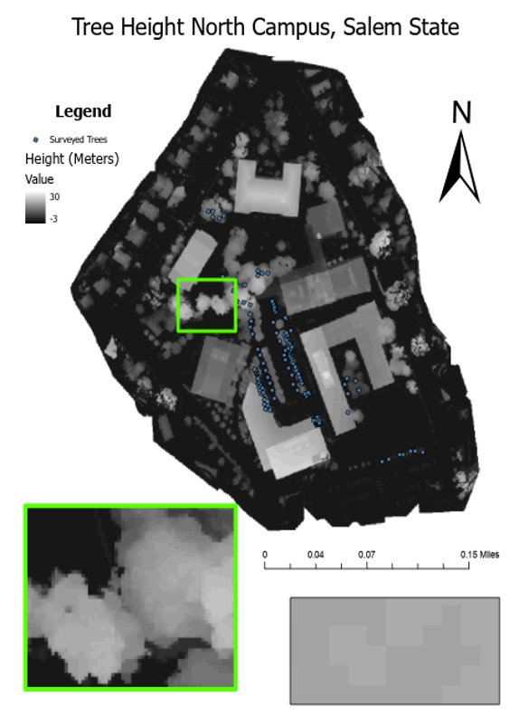
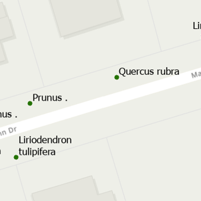
This map shows the DEM created using a DJI Phantom Pro 4 drone with tree survey points overlayed.
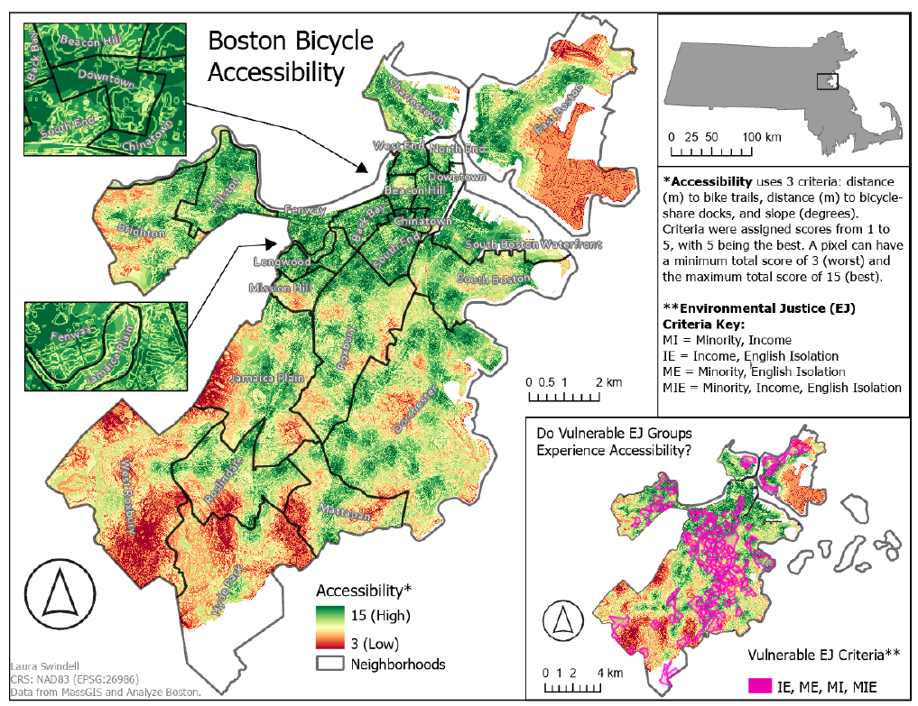
This is the accessibility map for slope and distances to infrastructure. In the inset map depicting Boston,
both the Boston neighborhood layer and the vulnerable EJ groups layer are overlaid to visualize the accessibility of
individual vulnerable EJ designated census block groups.